
March 25, 2024
- 10 min read
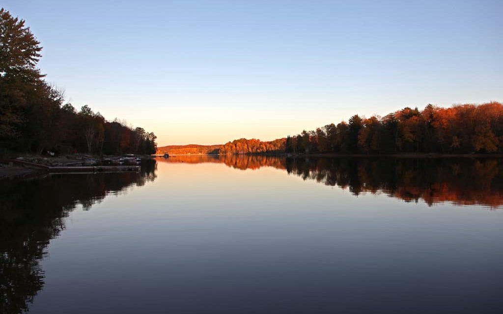
Welcome to Kawagama Lake, one of the largest lakes in the region that has something to offer, no matter what your interests are.
If you love boating, you’ll be delighted to know that there are two marinas on the lake’s west side, namely Mountain Trout and Old Mill Marina, which offer storage and repair services to keep your boat in its prime condition. With over 31 km of crystalline lake to explore, you can watch out for the ever-present loons and ducks while fishing for brook trout, lake trout, lake whitefish, and round whitefish. If you’re passionate about fishing, you can even register in the Kawagama Lake Cotters Association’s Fishing Derby, regardless of your fishing skills.
If boating and fishing aren’t your cup of tea, you can immerse yourself in the crystal clear water on a hot summer day, jump into the lake off the dock, swim around, or relax on a floating island. You can also grab a canoe or kayak and paddle around Dennison or Bear Island, which will fuel your body with exercise and your soul with a breathtaking
Your fun doesn’t have to stop once you’re off the water. You can take a trip to the village of Dorset, which is only ten minutes away, to stock up on all the essentials needed for the perfect cottage vacation. While there, you can check out the locally famous Dorset Lookout Tower, which offers a 360-degree view of the beautiful landscape. You can also visit Robinson’s General Store, voted Canada’s Best Country Store, or the Dorset Heritage Museum, perfect for a stormy summer day.
If you’re ready to start searching for your dream cottage, we can help make your dream a reality!
| Location | |
|---|---|
| Official Name | Kawagama Lake |
| Local Names | Hollow Lake |
| County/District | Haliburton |
| Municipality | Township of Algonquin Highlands |
| Drainage Basin | Muskoka River – Hollow River |
| Latitude/Longitude | 45.401 N 78.746 W |
| Physical Features | |
|---|---|
| Surface Area (km) | 31.50 |
| Elevation (m asl) | 383 |
| Mean Depth (m) | 22 |
| Maximum Depth (m) | 73 |
| Perimeter (km) | 109 |
| Island Shoreline (km) | 24 |
| Clarity (m) | 7.9 |
| Land Use and Development | |
|---|---|
| Crown Land (%) | 60 |
| Provincial Parks | none |
| Shoreline Development | moderate; shoreline residential, commercial, recreation camp |
| Access | public and private; public launches at Kawagama Lake Road, Bear Lake Road and McClintock Road; private launches at marinas |
| Water Level Management | regulated; water level is controlled by MNR owned and operated dam at west end of lake; flows and levels are governed by the Muskoka River Water Management Plan |
| Fish Species | |
|---|---|
| Major Fish Species | brook trout, lake trout, lake whitefish, cisco (lake herring), round whitefish, rainbow smelt, burbot, rock bass, smallmouth bass, yellow perch, walleye, northern pike |
Other Fish Species | lake chub, northern redbelly dace, pumpkinseed, finescale dace, ninespine stickleback, brook stickleback, brown bullhead, white sucker, Iowa darter, common shiner, bluntnose minnow, blacknose dace, longnose dace, creek chub |