
March 25, 2024
- 10 min read
Lake Muskoka is a stunning lake that attracts many tourists due to its beauty and convenient location. It’s a perfect spot for city dwellers looking to escape their busy lives and unwind. Covering an area of 121 kilometers, Lake Muskoka is the largest inland lake in the region, with an average depth of 18 meters. It has crystal clear water, excellent fishing opportunities, and a vast mixed shoreline to explore.
Fishing is one of the most popular activities to do on Lake Muskoka. The lake trout population is immense, and you can also find other species, such as walleye, herring, brook trout, rainbow smelt, and whitefish. There are several public boat launches in Gravenhurst, Bracebridge, and Bala, making it an ideal spot for experienced fishermen. For novice fishermen, fishing charters are an excellent option to explore the lake.
Because Lake Muskoka is a massive lake with several bays, points and islands, it is perfect for water sports. Activities such as sailing, water skiing, canoeing, and swimming are among the most popular. The lake has several bays, points, and islands, providing a vast area to explore. And with miles of boating just in Lake Muskoka, consider the fun to be had crossing over into Lake Rosseau and through to Lake Joseph.
If you prefer off-water activities, you can try your hand at golfing at The Fairways at Kirrie Glen or Taboo Resort or visit one of the many public parks in the area for a fun-filled afternoon of beach volleyball, sunbathing, and other activities. The Muskoka Lakes Museum and nearby theatres, such as the Gravenhurst Opera House and Rene M. Caisse Theatre, are excellent cultural spots to explore.
As with Lake Joseph and Lake Rosseau, luxury cottaging is no stranger to Lake Muskoka. Many celebrities call it their vacation home destination. The most luxurious properties are situated along Millionaire’s Row, and there are several local steamship cruises along the row to take it all in. So while exploring Muskoka’s beauty, you may spot Kurt Russell or Tom Hanks.
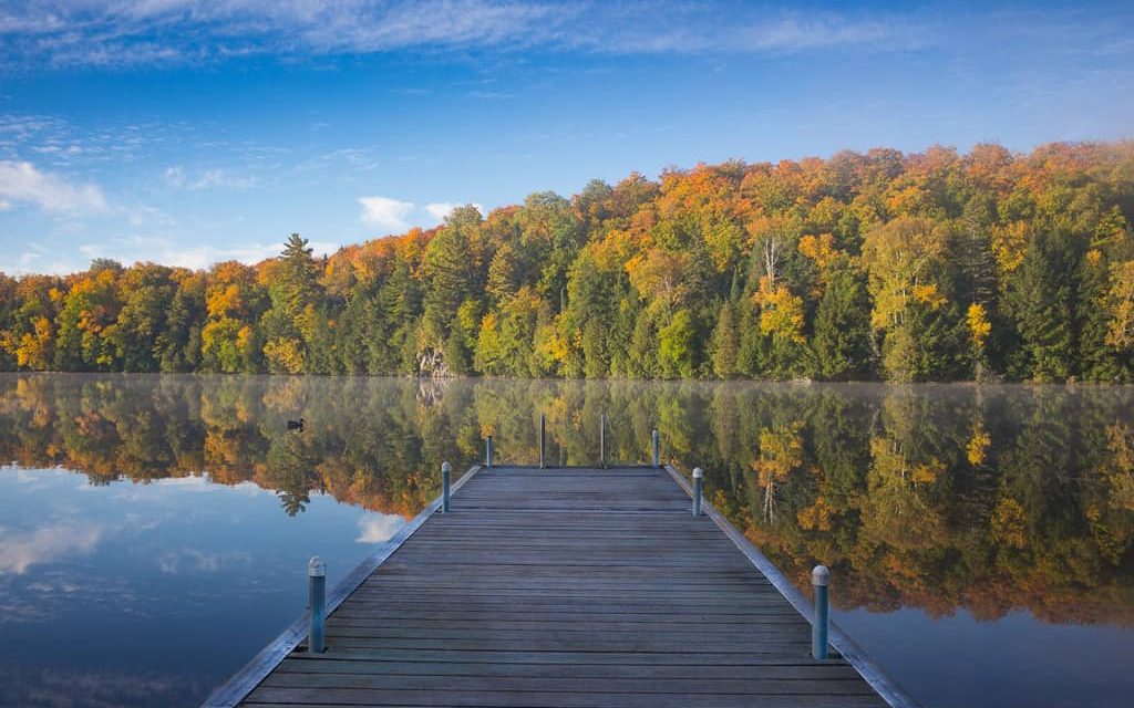
While summer is the peak season on Lake Muskoka, late fall and winter are the best times to visit if you prefer a quieter experience. The changing leaves provide a beautiful backdrop, and you can ski, snowmobile or snowshoe through some of the best cottage country trails.
Whether you come for a weekend or a month, Lake Muskoka is an ideal spot for a vacation. And you decide when it ends.
| Location | |
|---|---|
| Official Name | Lake Muskoka |
| County/District | Muskoka |
| Municipality | Township of Muskoka Lakes |
| Drainage Basin | Muskoka River |
| Latitude/Longitude | 45.054 N -79.475 W |
| Physical Features | |
|---|---|
| Surface Area (km) | 121 |
| Elevation (m asl) | 225 |
| Mean Depth (m) | 18 |
| Maximum Depth (m) | 73 |
| Perimeter (km) | 269 |
| Island Shoreline (km) | 209 |
| Clarity (m) | 3.5 |
| Land Use and Development | |
|---|---|
| Crown Land (%) | 0 |
| Provincial Parks | Hardy Lake Provincial Park |
| Shoreline Development | intense; urban, commercial, shoreline residential |
| Access | public; public launches in Bracebridge – George Road, Beaumont Drive; Gravenhurst – Muskoka Wharf; Bala; Milford Bay and others; private access through several marinas |
| Water Level Management | regulated; water level is controlled by MNR owned and operated dams at Bala; flows and levels are governed by the Muskoka River Water Management Plan |
| Fish Species | |
|---|---|
| Major Fish Species | brook trout, lake trout, lake whitefish, cisco, rainbow smelt, northern pike, burbot, smallmouth bass, largemouth bass, walleye |
Other Fish Species | longnose sucker, white sucker, lake chub, golden shiner, common shiner, blacknose shiner, spottail shiner, spotfin shiner, bluntnose minnow, black bullhead, brown bullhead, margined madtom, trout-perch, rock bass, pumpkinseed, black crappie, yellow perch, Iowa darter, logperch, cisco, slimy sculpin, Spoonhead Sculpin |