
March 25, 2024
- 10 min read
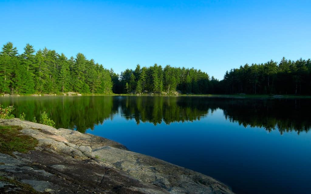
Welcome to Lake of Bays, the largest lake in Lake of Bays Township and the second largest in the Muskoka River Watershed. Its expanse stretches from Dwight village on the northeastern shore to Dorset and Baysville towns on the southern shore, offering countless opportunities in and around the lake.
Lake of Bays boasts many beaches perfect for swimming and relaxation. Dwight Beach, with its soft sandy beach, picnic tables, Muskoka chairs, docking, and boat launch, is an excellent spot to dive into the waters. Lake of Bays Beach and the Dorset Parkette on the Dorset side of the lake also has a beautiful public beach, picnic area, seasonal restrooms, boat launch and dock, perfect for swimming, canoeing, and kayaking. The water is clean, cool, and pristine, and the beaches are usually uncrowded.
Boating enthusiasts will find Lake of Bays easy to navigate with its vast surface area. Several marinas, such as Port Cunnington Marina and Lake of Bays Marina at the north end of the lake, provide high-capacity fuel docks, docking slips, boat rentals, storage, and full-service. You can also enjoy the Watersport Academy and Water Ski Shows every Saturday during the summer at Lake of Bays Marina.
Fishing is popular on Lake of Bays, with the primary species being lake trout, northern pike, smallmouth bass, lake whitefish, largemouth bass, and walleye. The Lake of Bays Sailing Club offers a Junior Sailing Program that attracts kids and teens from all over Lake of Bays, Weekend Racing and Family Sailing events, and their Annual Club Championships.
Whether you’re looking to swim, fish, wakeboard, tube, or explore the nearby towns, Lake of Bays has something for everyone. Contact us to learn more about purchasing a cottage or home. You will love it here!
| Location | |
|---|---|
| Official Name | Lake of Bays |
| Local Names | Fork Lake |
| County/District | Muskoka |
| Municipality | Township of Lake of Bays Town of Huntsville |
| Drainage Basin | South Muskoka River |
| Latitude/Longitude | 45.256 N 79.002 W |
| Physical Features | |
|---|---|
| Surface Area (km) | 67.80 |
| Elevation (m asl) | 316 |
| Mean Depth (m) | 22 |
| Maximum Depth (m) | 70 |
| Perimeter (km) | 167 |
| Island Shoreline (km) | 31 |
| Clarity (m) |
| Land Use and Development | |
|---|---|
| Crown Land (%) | 0 |
| Provincial Parks | none |
| Shoreline Development | high; urban, shoreline residential, commercial |
| Access | public and private; public launches at Old Hwy 117, South Portage Road, Rabbit Bay, Dwight; private access through several marinas |
| Water Level Management | regulated; water level is controlled by MNR owned and operated dam in Baysville; flows and levels are governed by the Muskoka River Water Management Plan |
| Fish Species | |
|---|---|
| Major Fish Species | brook trout, lake trout, lake whitefish, cisco, northern pike, smallmouth bass, walleye, black crappie |
Other Fish Species | rainbow smelt, longnose sucker, white sucker, brown bullhead, burbot, trout-perch, rock bass, yellow perch, bluntnose minnow, common shiner, mottled sculpin, pumpkinseed, slimy sculpin |