
March 25, 2024
- 10 min read
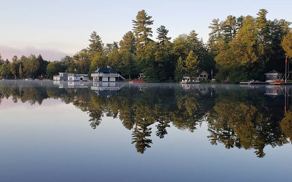
Lake Rosseau, situated 200 kilometres north of Toronto, is widely recognized as one of the most prestigious lakes in Ontario. Being one of the Big Three, along with Lake Muskoka and Lake Joseph, it is part of a series of interconnected lakes that provide over 500 kilometres of shoreline for visitors to explore and enjoy.
As a vast lake with several bays and islands, Lake Rosseau offers ample opportunities for all sorts of water sports and activities, including sailing, water skiing, wakeboarding, canoeing, swimming, and fishing.
For those seeking fine dining options in the area, the J.W. Rosseau Resort is a top choice. It features award-winning restaurants that offer expertly prepared prime cuts and Italian cuisine, as well as an Ice Bar where guests can indulge in tapas served in a -15° setting and signature flights of Crystal Head Vodka.
Beyond food and drink, Lake Rosseau has much to offer. The charming village of Rosseau on the north side of the lake is home to the legendary Rosseau General Store and the Rosseau Ball Diamond and Field House, which features a multi-purpose play area. The Rosseau Waterfront Park, located nearby, is a landscaped park with a sandy beach, a large playground, picnic facilities, a boat launch, public washrooms and change rooms equipped with showers.
On the south shore of Lake Rosseau, visitors can explore Port Carling, the hub of the three Muskoka lakes. This area is known for its friendly local businesses, beautiful shops, and attractions such as the Muskoka Lakes Museum.
Whether you prefer lounging by the lakeside, touring the lakes on a boat, exploring trails, or discovering local attractions, Lake Rosseau has something for everyone.
| Location | |
|---|---|
| Official Name | Lake Rosseau |
| County/District | Muskoka, Parry Sound |
| Municipality | Township of Muskoka Lakes Township of Seguin |
| Drainage Basin | Lake Rosseau |
| Latitude/Longitude | 45.1739 N 79.5850 W |
| Physical Features | |
|---|---|
| Surface Area (km) | 63.90 |
| Elevation (m asl) | 225 |
| Mean Depth (m) | 24 |
| Maximum Depth (m) | 89 |
| Perimeter (km) | 151 |
| Island Shoreline (km) | 80 |
| Clarity (m) | 5.4 |
| Land Use and Development | |
|---|---|
| Crown Land (%) | 0 |
| Provincial Parks | none |
| Shoreline Development | intense; urban, commercial, shoreline residential |
| Access | public; public boats launches at Rosseau, Port Carling, Skeleton Bay; private access at numerous marinas; navigation lock from Lake Muskoka at Port Carling water access from Lake Joseph at Port Sandfield and Joseph River |
| Water Level Management | regulated; water level is controlled by an MNR owned and operated dam at Port Carling; flows and levels are governed by the Muskoka River Water Management Plan |
| Fish Species | |
|---|---|
| Major Fish Species | lake trout, lake whitefish, cisco, walleye , smallmouth bass, largemouth bass, muskellunge, northern pike, burbot, black crappie |
Other Fish Species | rainbow smelt, spottail shiner, pumpkinseed, brown bullhead, creek chub, rock bass, ninespine stickleback, white sucker, golden shiner, slimy sculpin, yellow perch, bluntnose minnow, emerald shiner, logperch |